
Science Programs
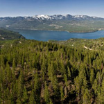
Whitefish Water Quality Monitoring Program
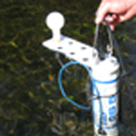
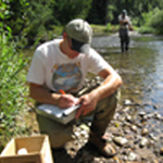
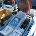
WLI developed data collection parameters, obtained data collection equipment, and increased the level of scientific research on Whitefish Lake, its tributaries and local area steams. Because most pollutants and water chemistry changes are invisible to the naked eye, one cannot evaluate water quality solely by visual inspection. Similarly, because water chemistries and conditions change seasonally and annually, one cannot understand overall lake dynamics by monitoring it for a year or two. It requires that specific measurements be evaluated in respect to one another over time to gain a holistic understanding of the resource and any changes to it.
WLI has been collecting baseline data at two permanent sites on Whitefish Lake and on its tributaries since 2007. Data collection typically starts in April and runs through November. Data is collected on all of the lake’s tributaries; Hellroaring Creek, Lazy Creek, Smith Creek, Swift Creek, Beaver Creek and Viking Creek, as well as local streams Cow Creek, Haskill Creek, Walker Creek, and the Whitefish River. WLI also conducts annual sampling of Whitefish Lake and Beaver Lake for Aquatic Invasive Species (AIS) such as Eurasian watermilfoil, and zebra and quagga mussels. See AIS page for more information.
WLI and partner data are available in the Whitefish Water Resources Report: A Status of the Whitefish Lake Watershed and Surrounding Area.
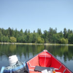
Whitefish Water Quality Monitoring Sampling Locations
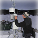
Lake Ice Observation Map
This is a map created from our Lake Ice Observation Survey. This is publicly created data and SHOULD NOT be used to make ice safety assessments.
This map shows ice cover, to see the legend click the arrows in the top left corner of the map. To learn more about each data point click on the point.
If you would like to participate by making your own lake ice observations the survey is linked HERE.
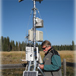
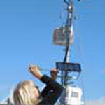
Atmospheric Station
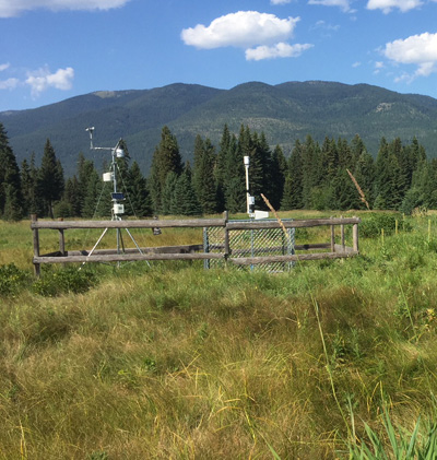
WLI installed and maintains an Atmospheric Station near Lazy Bay and partners with the University of Montana’s Montana Climate Office on the Mesonet Meterological and Soil moisture information network.
Current data and graphic display of the past two weeks can be accessed here.
The historic data from this station can be visualized and downloaded in daily or monthly summarized through a new download portal.
Biological Communities Research
As described in WLI’s Whitefish Water Resources Report: A Status of the Whitefish Lake Watershed and Surrounding Area, Whitefish Lake is oligo-mesotrophic, meaning its water quality can easily be influenced toward decline. Of the many factors that influence water quality, the trophic structure of the lake has received little attention. WLI is conducting research on the biological communities of the lake in an effort to better understand that trophic structure.
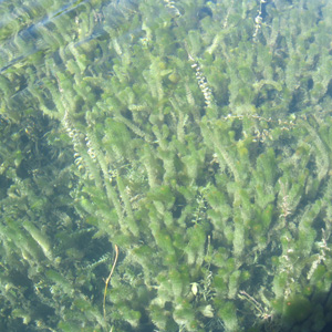
Macrophytes
In 2013, WLI conducted a 395 point macrophyte and substrate survey along the Whitefish Lake shoreline The survey consisted of determining the composition and relative abundance of plant species at each location, along with characterizing the lake substrate to determine areas suitable for plant colonization. No exotic invasive species were found. Six additional lakes were chosen for macrophyte surveys and early AIS detection in 2014. Lakes were chosen based on proximity to Whitefish Lake and include: Blanchard, Dollar, Lost Coon, Murray, Skyles and Spencer. Lakes were sampled within the first eight days of September. Additional surveys have been conducted by WLI for early detection monitoring of Eurasian watermilfoil (EWM) at many locations including Beaver Bay, Lazy Bay, State Park, the outfall of Viking Creek and City Beach. No EWM was discovered during the surveys, however, additional surveying will continue based on suitable areas for colonization, recreational pressure, and proximity to Beaver Lake which does have EWM. Results of these studies can be found in the Whitefish Water Resources Report: A Status of the Whitefish Lake Watershed and Surrounding Area.
Aquatic Macroinvertebrates were sampled by WLI and analyzed by Rithron Associates in 2015 to determine community assemblages and their relative pollutant tolerance. WLI sampled Whitefish Lake as well as its tributaries including the East Fork of Swift Creek, West Fork of Swift Creek, Swift Creek Mainstem, Lazy Creek, Hellroaring Creek, Beaver Creek, Viking Creek, Upper Whitefish River, Cow Creek, Haskill Creek, and Walker Creek. Macroinvertebrates such as insects, worms, mussels, and snails, tend to be sensitive—in varying degrees— to pollutants. When found in large numbers, macroinvertebrates that require high dissolved oxygen levels tend to indicate good water quality. Because many macroinvertebrate community assemblages change with declining water quality, they are good indicators of negatively impacted water quality. Existing populations can also elucidate specific aquatic ecosystem changes such as increases in sediment and thermal pollution. Sampling and identifying macroinvertebrate life allows researchers to set a baseline of water quality from which to measure any changes. Thanks to funding from the Cadeau Foundation, WLI now has a professionally conducted baseline macroinvertebrate study that helps describe the health of Whitefish Lake tributaries, Whitefish Lake, and Whitefish Lake Watershed streams. This information will also be used to compare future research results, allowing WLI to report changes from outside influences such as development, pollutants, and climate. Results from this baseline survey can be found in the Whitefish Water Resources Report: A Status of the Whitefish Lake Watershed and Surrounding Area.

Mysis Shrimp
Mysis shrimp (Mysis diluviana) are a nonnative species introduced to Whitefish Lake in 1968, and a species of concern regarding the trophic status of the lake. Mysis have had significant adverse impacts on the Flathead Lake ecosystem, so it is important that we assess their population densities and distribution locally. Mysis studies are be compared to prior studies in the 1980s to provide a necessary update regarding the trophic status and dynamics of Whitefish Lake. Results inform management activities on the relationship to fish populations and nutrient cycling to understand food web dynamics for recreational angling, and for the overall economic benefit of the lake to the community. The introduction of Mysis shrimp has been described as the most deterministic event in the legacy of Flathead Lake and the Flathead Basin. Mysis introductions were expected to provide a food source for benthic-feeding fishes such as lake trout, and for pelagic planktivores such as kokanee salmon. However it was later discovered that the expected increased forage for kokanee salmon from the Mysis shrimp transplant was based on erroneous interpretations of the results of introductions elsewhere.

Periphyton
Periphyton is a complex mix of algae, cyanobacteria, microbes, and detritus that is attached to submerged surfaces in aquatic ecosystems. Like macroinvertebrates, periphyton is an important water quality indicator because it is sensitive to and responds quickly to change, and is fairly easy to sample. Periphyton has long been used as a water quality indicator in lotic systems (streams and rivers), but no metrics have yet been developed for determining periphyton tolerance in lentic systems (freshwater lakes). This study not only provides a needed benchmark for the Whitefish Lake Watershed, but will also have a multiplier effect, furthering science through the development of periphyton analysis for other lakes in the northwest Montana region. Understanding periphyton will further WLI’s knowledge of and ability to manage the waterbodies of the Whitefish Lake Watershed and provide aquatic resource managers with a new management tool. Thanks to funding provided by the Cadeau Foundation, WLI has baseline periphyton information for a better description of the health of Whitefish Lake.

Rangewide Bull Trout eDNA Study
WLI participated in the U.S. Forest Service (USFS) Rangewide Bull Trout eDNA Study in the Whitefish Lake Watershed by collecting samples in local streams in 2017 and 2018. Environmental DNA (eDNA) refers to fragments of genetic material from plants or animals that naturally occur in the environment. In the case of fish, DNA is contained in cells that are continually shed into the water, thus becoming “eDNA.” Each species of DNA is unique and can be detected in very small quantities. Scientists can now quickly confirm if a certain species is present in a stream by filtering the water and using laboratory analysis to look for its unique DNA.
The USFS states on the Rangewide Bull Trout eDNA Project website that though once abundant, Montana’s native bull trout have declined in many locations and are at risk from a changing climate, non-native species competition, and habitat degradation. The Rangewide Bull Trout eDNA Study is determining the distribution of bull trout throughout the Pacific Northwest. Thanks to this funding, WLI is one of many organizations contributing to this effort.
eDNA sampling is a relatively new, exciting tool with high cost-effectiveness in determining population structure and answering other questions. WLI has utilized eDNA technology since 2013 as it relates to determining presence/absence of aquatic invasive species, now an increased threat in the Watershed. This technology is constantly being refined to facilitate sound management of our aquatic resources.
Bull Trout eDNA Results
WLI collected samples for the Lazy, Swift, and Haskill drainages. Bull trout were absent in Lazy and Haskill Creeks. Since we know that bull trout utilize the mainstem of Swift Creek, and the West Fork of Swift Creek, WLI prioritized sampling efforts on tributaries to those streams.
Notable findings from the survey include the presence of bull trout in lower Chicken, Antice and Stryker Creeks. Montana Fish, Wildlife & Parks have no prior records of bull trout in those streams. It could be that juvenile bull trout move up these streams to rear before out-migrating to Whitefish Lake, however, further surveys are needed to determine the full distribution, while field verifying the eDNA results.
Understanding the life history needs for the Whitefish Lake / Swift Creek bull trout population is vital to protect this threatened species. Since 1998, the number of bull trout redds (spawning nests) in Swift Creek and the West Fork of Swift Creek have ranged from 5-17. The average for the last six years was 12.8, demonstrating perilously low numbers for this adjunct population. Recovery of this population will be difficult given the strong food web control by the expansive lake trout population in Whitefish Lake.

The Northwest Montana Lakes Network (NMLN) is a citizen science program that grew out of two monitoring programs previously underway at the Flathead Basin Commission (FBC) and the Whitefish Lake Institute (WLI). The Flathead Basin Commission, in cooperation with the University of Montana Flathead Lake Biological Station, coordinated the Volunteer Lakes Monitoring Program (VLMP) from 1992-2010. The VLMP trained, equipped and supported local volunteers who collected data and reported on over three dozen lakes in the Flathead Basin.
The Environmental Protection Agency (EPA) and FBC programs were the baseline models for the Whitefish to Eureka Volunteer Lake Monitoring Program (VLMP) which was initiated in 2007 by WLI in partnership with Montana Fish, Wildlife & Parks (MFWP). The Program was established to provide local residents an opportunity to collect baseline data that to help determine the trophic status of lakes and implement early Aquatic Invasive Species (AIS) detection and prevention in Northwest Montana. In 2010, the Whitefish to Eureka VLMP combined with the FBC VLMP to form the NMLN. The NMLN currently has more than fifty volunteers that monitor a total of fifty locations on forty-one lakes in Flathead, Lake, Lincoln and Missoula counties. The lakes in the network represent diversity in public use, accessibility and morphology.
Through this program, WLI trains “citizen scientists” to monitor lakes by collecting basic limnological measurements such as temperature and Secchi disk readings. WLI staff also collects water chemistries, Hydrolab profiles, and plankton tows to establish lake trend data over time, and to monitor for the presence of AIS. Many of these lakes previously had no scientific data. The partnership enables WLI to extend its monitoring reach through volunteer efforts, while involving community members in understanding and protecting their natural resources. The NMLN website nmln.info allows volunteers to access information, report their data, and stay abreast of AIS issues. Volunteers contribute nearly 1000 hours to NMLN annually.


For more photos on Aquatic Invasive Species, visit
Northwest Montana Lakes Network website.
Download the NMLN 2021 or review water chemistry comparison charts.